Mike's Blog

Welcome to the blog! Mike posts regularly on all things flying. From training tips to the latest aviation news, be sure to check back regularly.


Mountain flying

When you read the words mountain flying, you probably think of the Alps, the Rockies or a French ‘altiport’. But there are some mountain considerations even flying in the UK.

Firstly the rules – there is an EASA Mountain Rating – and you must hold it to use some of the high altitude ‘altiports’.

Secondly, no qualification is needed to fly over mountains., just a bit of knowledge and common sense. Today I flew over Wales to Llanbedr, and this prompted me to write down some tips for flying over mountains which I first learnt in Colorado:

  1. MSA – take this very seriously! Aim to be at least 1000 ft above the peaks, and preferably 2000 ft for reasons that are revealed below. Remember that you should base your MSA on peaks on- and off- track. In poor visibility it is easy to wander. Granite hurts!
  2. Updrafts, downdrafts and turbulence – You can expect updrafts on the windward side of mountains, and downdrafts and turbulence on the leeward side. Today, that meant that -with an easterly wind- I found myself reducing power to avoid gaining height as I approached Snowdonia, and encountered a lot of turbulence in the descent in towards Llanbedr. Conversely on the return trip, it was mightily bumpy even at 4000 ft (1000 ft above the highest peaks of Cadair Idris at 3000 ft) but much smoother at 4500 ft.
  3. Fly the valleys or over the peaks? This depends how much you want to climb and how comfortable you feel flying up a valley with rocks on both sides. Fortunately, most UK mountains are low enough that we can generally fly over them – not the case in the Rockies!
  4. Plan your climb and descent – on the way in to Landbedr, I needed to descend from 4000 ft to circuit height – this needs to be gradual to avoid over-cooling the engine. A straight line direct routing may create a very abrupt descent. A slightly circuitous sightseeing route is maybe a good plan. Likewise on departure – I needed to get back up to 4000 ft before heading for the hills.
  5. Know your aeroplane – what climb rate can you expect at 4000 ft? Will a climb from sea-level to 4500 ft cause over-heating? I decided to remove my oil cooler baffle plate for the return journey.
  6. Keep your back-door open – in other words: know which way you will turn and what heading you will fly if something does not go according to plan – poor visibility, reduced climb performance, engine over-heating, severe turbulence etc.

And the by way, it was a great trip.

Best practice PLOG

Do you find that there isn’t enough space on your PLOG to make notes and record clearances?

Have you ever mis-read the columns and flown your ground speed as a heading?

You choose to climb to avoid weather but the base of CAS is hard to read on the chart and is not on your PLOG?

After lots of experimentation and input from students, I have printed some new and improved PLOG pads for VFR and IFR flying. The IFR PLOG also contains all the elements which a VFR CPL pilot needs.
They are designed for clarity, and to avoid the kinds of reading errors which are commonly made on a  crowded A5 PLOG. Guidance on how to use them is given on the Downloads area under Planning Tools.

If you would like some sample sheets to try out, please get in touch.
They are also  available as 25 or 50 sheet pads at a modest cost.

Flight Examiner

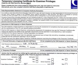
I am pleased to announce that I have passed the Assessment of Competence for the PPL Flight Examiner certificate. This means that I can now conduct LAPL(A) and PPL(A) skill tests, IMCR / IR(R) skill tests and LST / LPC tests for SEP rating issue / re-validation.

News on the BIR

EASA has published its Opinion on the BIR, the Basic Instrument Rating. “Opinion” is the term for the proposal to the European Commission. If accepted (an Opinion usually is), it will become the legal basis for the BIR, expected to come info force in 2021.

The overall goal of the BIR is to make an instrument rating more accessible and affordable for GA pilots, with benefits of safety and usefulness of the PPL licence.

In summary, the Opinion states that:

  • The BIR can be attached to a PPL but not a LAPL
  • It will be “fully competence-based” with no minimum training hour requirements
  • Training will be divided into 3 / 4 separate modules
    1. basic instrument flight
    2. approaches & departures
    3. en route
    4. if applicable, asymmetric flight
  • There will be a single theory examination for each module
    • The exam will not re-test PPL level knowledge
    • Its “scope and depth” will be “broadly similar” to the FAA IR TK
    • The questions will be drawn from the existing question bank (the ECQB)
    • Only an ATO will be allowed to provide training for the BIR “for the time being”. EASA intends to monitor the implementation of Part-DTO in order to evaluate, at a later stage, whether DTO training scope could be extended to include further ratings like the BIR
  • The EIR will be withdrawn, though current EIR holders may continue to use their privileges indefinitely
  • The BIR will be valid for 1 year. Re-validation will be by proficiency check or 1 hour instruction (to be applied in alternate years)

The BIR is similar in concept to our IMC rating (IMCR or IR(R) ) with 2 very important additions:

  • It will allow flight in class A airways
  • It can be used all over Europe (but not outside, as ICAO compliance has not (yet) been demonstrated

Practical use

Like our IMCR, it will have higher minima than the full IR but these will be mandatory (those for the IMCR are recommendations):

  • On departure, visibility must be ≥ 1500 m & ceiling must be ≥ 600 ft or circling minimum, if higher
  • For approaches, the visibility minimum must be ≥ 1500 m & the pilot must add 200 ft to the (M)DH.
  • Before departure, the destination & any required alternates must be forecast to have a visibility of ≥ 1500 m and a ceiling of the highest of 600 ft, the circling minimum, and the increased (M)DH

What this means for us in the UK depends on the outcome of Brexit and whether the UK remains in the EASA ‘club’. If we do, the CAA intends that the BIR will replace the IMCR, and expects to offer ‘a generous credit’ for IMC rating holders. Because of the BIR’s greater scope, we should expect additional TK (theory knowledge and exam) requirements and a flight test. In the event of leaving EASA, the CAA is committed to retaining the IMCR or something similar.

Brexit notwithstanding, this is good news: the BIR is an affordable and accessible instrument rating that can be used all over EASA land. The only disappointment is that we are going to have to wait 2 years to get it.

How do you use Skydemon?

It was too windy to go flying last week, so I spent an afternoon thinking about the different ways we can use aviation planning and navigation app’s. I have been a SkyDemon user for some years but I think that this blog is equally relevant to other app’s like EasyVFR and Runway HD.

We can use the app’s in 4 main ways – planning, in-flight navigation, traffic alerting and de-briefing.

In planning mode, we can use it for

  • Planning a route and cruise altitude, avoiding CAS and operating above MSA
  • Checking weather & NOTAM’s
  • Identifying high terrain
  • Creating a navigation PLOG
  • Generating a Frequency list
  • Printing a charts and airfield plates
  • Planning the circuit join
  • Filing flight plan & GAR forms

In flight
I believe Skydemon is best used as back-up to primary navigation using a chart, for occasional position checks and general situational awareness. In that context its commonest uses are for

  • Airspace warnings
  • Terrain avoidance

But it can also help in

  • Finding a difficult-to-spot airfield
  • Emergency navigation e.g. unexpected IMC, VFR on top (flight above cloud), diversions
  • As a back-up instrument set (e.g. GPS altitude, track and Ground speed)
  • ATC position reports
  • Electronic flight bag (EFB) – holding a PLOG, airfield plates, and notepad
  • Joining the circuit
  • Flying a final approach track and glideslope

Traffic warning
The use of SkyDemon and similar app’s for traffic awareness and alerting is growing. They typically use a wi-fi link to onboard EC (electronic conspicuity) devices.

De-briefing
Once we’re back home, the record of our flight helps fill out the log-book, and we can review how we actually did against our planned route and altitude.Whatever your use of the app, it is important to understand the functionality before climbing into the cockpit, and also to check that it is set-up appropriately and consistently for your flight. To help with that, I attach this little check-list.

Happy flying!


Something festive

Over Christmas I’ll be taking a few days off from flying. Since we have young children visiting, we have prepared for the arrival of Santa, and this year he will even be able to fly our new and highly unconventional RNAV approach!

There will be more blogs in the New Year; meanwhile I send all my readers Seasons greetings!


First time visitor

I thought I’d share some experience of visiting new airfields. Occasionally visitors irritate home-based pilots as they don’t follow the circuit, and as a visitor myself I am sometimes uncertain how to go about the circuit join. Here’s how to get it right……

Starting with preparation:

  • Review the flight guide for circuit information – height, position, size / shape, type of join, and whether QFE or QNH is used. Skydemon (other apps are available) can also help here.
  • Make sure you understand the standard overhead join. It cannot always be used, and often it is modified. In some cases, the ‘geometry’ is followed but with modified heights due to CAS, in other cases, the heights are used but the geometry varies for noise abatement reasons.
  • Call for PPR and get a briefing – even if PPR is not required
  • If the wind is variable, plan for the possibility of a runway change and a different join
  • Decide what features will lead you to the airfield if it is difficult to spot – GoogleEarth is a great resource for this
  • If uncertain, ask advice from an instructor or someone familiar with the destination

And in flight:

  • A GPS, such as Skydemon may help you find the field if it is difficult to spot.
  • Call up in good time; monitoring the frequency will give situational awareness – how many aircraft are in the circuit, which circuit is used etc.
  • A standard overhead join (if allowed) gives you more time to spot the field and, get oriented and integrate with other traffic.
  • Look out carefully for other traffic, and listen out, especially for aircraft using a student call sign
  • Integrate considerately into the circuit – traffic already in the circuit has right of way over traffic joining. Calling ‘joining left base’ or ‘long final’ means you are beyond the circuit and joining in a non-standard way – you don’t have right of way!
  • Don’t expect everyone to be in exactly the right place – they may be visitors, or students.

A few examples illustrate some of these considerations:

  • Fenland EGCL uses a standard overhead join, which makes it easier to locate the field (it can otherwise be hard to spot without GPS), but you may use other joins if traffic permits.
  • Peterborough Conington EGSF uses standard overhead join heights, but for noise-abatement, the overhead join is offset from the landing threshold and the crosswind leg follows an old runway alignment and is not perpendicular to the runway in use.
  • Coventry EGBE lies under the Birmingham CTA, so the circuit is flown on QNH, an overhead join is not possible and you may wish to join downwind, or on a base leg (giving way to existing traffic).
  • Larger (towered) airfields like Norwich EGSH will instruct you how to join. They generally give the most expeditious route – to downwind, base or straight in, depending on the direction from which you arrive.

Partial power loss

From time to time, the CAA informs instructors and flying schools of topics which deserve additional attention. A recent one is ‘Partial Power Loss’.

We’ve all practiced EFATO’s and PFL’s, with an abrupt and total loss of power. Partial power loss is much more insidious. It’s easy to accept a poor climb rate, without realising what is happening, and there is always the temptation to keep pitching up to maintain a climb, resulting in a power-on stall.

There can be many reasons for partial power (e.g. plugs fouled, one magneto failed, fuel flow restriction, carb ice, failure of a constant-speed propeller mechanism etc etc) and they can occur at various altitudes. So there is no ‘one size fits all’ solution.

As general rules

  • maintain an airspeed not lower than best glide speed, or not less than Vx with obstacles to clear
  • understand what rpm in your aircraft is sufficient to maintain altitude
  • be ready for total power loss.

If you suffer partial power loss, first ask the question can I still climb? If so, climb to a safe altitude, and if close to the airfield, fly a close-in circuit and land. Don’t hesitate to make a PAN or MAYDAY call. If partial power occurs on a cross country route, and you can maintain altitude, them proceed cautiously to the nearest airfield and seek a straight in approach. Of course, I’d be looking for fields along the way, in case the engine fails. If you are not maintaining altitude, then a forced landing is inevitable, but the residual power gives you a little bit more choice and flexibility of location.

The ATSB in Australia have published a good document on the subject. It’s worth a read and can help think through some scenarios for our own aircraft. You may wish to try some of these with an instructor.

Weather decisions

It’s been a while since the last blog – I’ve been making the most of the exceptionally good weather. Forecasts for the last few days have included the possibility of thunderstorms and showers, so perhaps a few words on weather decision making are in order.

Some weather decisions are straightforward. If the observed cloud base or visibility are below VFR minima or your personal minima, you don’t go. If the cross wind is greater than the demonstrated aircraft limit, or your personal limit, you don’t go. You may think twice if the 2000 ft winds are greater than 35 knots: you could anticipate turbulence, ground speed into wind will be painfully slow, and the offset between track and heading may be confusing for cross-country navigation.

It gets a bit trickier if the forecast is poor but set to improve or vice versa. A BECMG trend in a TAF will always give a time range – so how to tell  when the weather will improve or worsen? Here are a few tactics:

  • Look at the actuals (METAR’s) upwind, and see what the trend is there. Similarly, you can call your destination airfield and ask what they observe.
  • Look at the visible satellite images on the Met Office website to see what the cloud trend is.
  • Examine the rainfall radar and observe how quickly the rain is coming in, and whether if is worsening or dissipating.
  • If similar trends have been forecast several days running, it may be reasonable to assume that the timing will mimic previous days. For example, in winter low cloud or fog early in the morning may be forecast to lift to reasonable VFR conditions later. Successive days have a habit of repeating themselves.
  • Use a more sophisticated tool like Autorouter’s GRAMET tool (details on our Planning >> Weather  page) for another interpretation of the forecast data.
  • Keep the back door open – it is better to fly towards forecast poorer weather, so you have the option of turning back. If you fly away from worsening weather, there is a chance that it will have arrived at your home airfield before you get back!

Another source of uncertainty are PROB30, PROB40 and TEMPO. With student pilots, we will often err on the cautious side i.e. assume these things will happen and not send them on a solo cross-country. But for personal flying, what shall we do? Here are a few tips:

  • ISOL and OCNL in the F215 mean exactly that – the phenomenon (typically showers) will be well-spaced, and it should be possible to fly around them.
  • TEMPO in a TAF means not more than 1 hour at a time, and not more than half the forecast period. So TEMPO +SHRA means we could avoid them by delaying our departure, or avoid a heavy shower at our destination by orbiting clear, if fuel state allows.
  • Weather radar is often helpful, as it can give an impression of how heavy and extensive the showers are, and also if they are intensifying or dying out.
  • And lastly, the trend observed on previous days may – if other conditions are the same (think temperature, pressure, air-mass type) – may also inform your decision.

Happy flying!

Crossing class D airspace

Earlier this year, NATS launched a portal for GA pilots wishing to transit Class D controlled airspace in the London area. It allows GA pilots to pre-notify their intentions via a simple, online tool.

The tool is currently a trial and use is not mandatory; indeed, it is perfectly OK to cross class D airspace by filing an airborne flight plan, 10 minutes prior to entering CAS, which you effectively do by calling them up and asking for a zone transit. By giving advance warning (1 hour before crossing), NATS say that it allows controllers to plan for your transit.

Some tips for planning a class D transit:

  • Have a route in mind, taking into account the runway in use, which you can work out from the wind direction or by phoning an ATIS telephone line (ATC often prefer you to transit via the landing threshold)
  • Plan your route and altitude so as to avoid wake turbulence. You want to be above the approach path of inbound commercial aircraft (a threshold transit does this)
  • Familiarize with VRP’s shown on the chart, and other features which ATC may reference (the Diamond hangar at Stansted, for example)
  • Be professional in your RT calls: be concise and complete (CARPACER), no waffle, read back accurately
  • Have a back-up plan ready, in case the transit cannot be approved
  • Fly the cleared routing accurately (heading and altitude) – this reassures ATC that you know what you are doing
  • Be ready to fly faster than normal if ATC request it (though in our GA aircraft, you won’t have much speed upside!).

I have used the tool several times. The functionality is quite basic – it doesn’t save data, nor does it allow you to specify your transit route (you simply state which class D CTR you wish to cross). The tool doesn’t guarantee that transit will be approved, but so far it has worked for me even at very busy times.